Tuesday, November 10, 2015

Hwy 50 $$

All good things have to come to an end...sort of so it was time for us to head back to SC.  If it was up to me I would have stayed ! My Mom has this attachment to SC and her home here so since winter is on the way anyways back we came.  We I decided to take 50/550 down to I-40 then across the country...

This means we actually traveled West on I-70 out of Silt, CO to hook up with 50 South 


and over the The Million Dollar Highway (Ouray to Durango) billed as one of the most scenic drives in America it is part of the San Juan Skyway and was built in the 1930's...the road was originally laid out by a Russian emigrant Otto Mears in 1880.

  The Red Mt Pass section is riddled with S curves and the posted speed limit is 10 mph  THE next 3 not my photos I was driving so shots like this one I didnt get due to mom would have killed me!  We have traveled this road a couple times before but it never gets old!

Million Dollar Highway
web photo
  It travels over 3 passes, Coal Bank Pass, 10,640 ft, Red Mt Pass 11,018 ft, and Molas Pass 10,970 ft. There is a very nice campground at Molas Lake if you're ever there during the right season... Montrose, Ouray (pronounced Uray) Telluride, Silverton, Durango, are some of the towns along the route in CO....I know all of you have heard of the narrow gauge  train that rides through the area...I've never taken the ride but I think I would enjoy putting that on my bucket list....I do believe the 2nd week of Sept would be prime leaf view time for a ride through the                                                                                  San Juan mountains we got there way too late for that.  
web photo
I though of going down via 191 BUT I knew I would want to stop we'd never make it out of Utah! The big deal on Hwy 50/550 is traveling through the San Juan Range. It's a beautiful drive.  The Red Mtn Pass is awesome not as narrow as Independence pass in my book it does get narrow in some spots  forget guardrails...there is barely room for the highway!we got a 10 start after a teary goodbye to my sister and Jimmy...we sure are gonna miss them and they us we hope..
  .MY dogs became part of their pack while I was away and they did really good in the town setting after spending their entire lives in the country...I enjoy driving so going over these passes is like candy to me! My Mom on the other hand will lean over in her seat trying to maneuver the van with her weight or something...lol I have to laugh I am not afraid nor intimated by the task but she closes her eyes, holds on for dear life and its fun to watch her but I know her fear is real and so I take my time I don't go fast and I stay focused on the road...
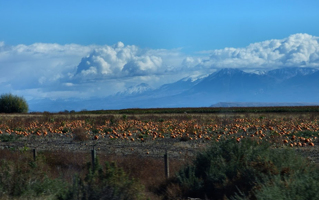
So we missed the fall color but we got there in time for the pumpkins  and the SNOW!


this area is called America's Switzerland! 


The Hotel Ouray..


This tunnel has a name but I swear I couldn't remember!


The Red Mt herself...


Every turn in the road brings another awesome view 


and the Red Mt Mining district has a lot of old mine shacks dotting the landscape...


The Yankee Girl Mine 1882 Silver mine


and another one I don't know the name of..


Then we eventually entered New Mexico in the upper NW corner, and I passed the turn off for Chaco Canyon its top of my next time bucket list...the van almost turned off by its self..lol


We got off I-40 a few times and onto the old route 66...I love the old motels and sights along it...


We drove through some Indian lands I admire the simple way of life...and the beautiful landscapes


and this was the last photo I took because I got into the East I just put petal to metal and we were once again HOME!


Quote from an Ouray local, "they couldn't pay me a million dollars to drive that road in the snow"!  I have to add.... me too!


PEACE

Eleanor Roosevelt: You must do the thing you think you can not.

Friday, November 6, 2015

Yellow Jacket Pass

I made the trip back to my sisters house with no more engine issues! Made me crazy that I ended up 4 days earlier than my planned arrival back to her house but At the time it seemed like the best plan...the drive back was awesome as I went right the way across Utah on I-70!  IT pained me to bypass Capitol Reef as I had planned it for my finale....but it ain't going no where :o)  On my past 2 visits out west I've visited  Arches, Canyonlands, Bryce, and Zion.  I still have manyyy Utah dreams to fill...an entire year would NOT give one the time needed...this trip I added Dinosaur and Antelope Island to my "visited" list. The  opportunities are endless as with each and every state!


Roadside awesomeness!

So back in CO a few days later we took a ride up to Meeker. 
Hwy 13 takes one there out of Rifle so up we went. Along the way is the Rifle Arch.  There is a trail to view it up close we didn't  hike as we had a full day planned we got a good view roadside..


 My sis and I both have a hobby of photographing graves for the website Find A Grave.  I haven't been doing much since gas prices shot up but now they are back in affordable range so my sis had some grave photo requests for the Meeker cemetery.  


We found only one of the graves sometimes there is no headstone...even tho the interred was listed in plots..  So we bundled the cemetery trip with a picnic and with a plan for some off roading!  (senior citizen style) We picnicked at the County Park in Meeker right by the Rio Blanco River.  The fall color was brilliant!


This shot was taken just upriver from the park, the park has a small RV park with electric and a dumpsite! Its small  maybe 3 or 4 sites I read on the Bayfield Bunch's blog they camped there just the other day...what a small world it is! ....I liked this mural in town...

--->missin photo

So we headed north on 13 and took the Yellow Jacket Pass.  It's a well graded gravel road that connects Meeker to Craig, and its about 42 miles end to end...we drove about half of it to the Milk Creek Battlefield site...it was such a beautiful drive! Here's some of what we enjoyed!...


windshield view


Most all the Aspens leaves had already peaked and fallen off but the oaks & such were very nice surrounding the sandstone formations!


We saw at least one McMansion along the way...


Yellow Jacket Pass. Road leads to the Battle of Milk Creek Memorial. General Nathan Meeker upset the Utes by trying to force them to become farmers. In September 1879, Meeker called in the army and on September 29, 1879, Chief Douglas and a group of warriors killed Meeker and seven other members of the agency. 


A dark storm cloud rolled in so we turned around rather than go on even in a 4 wheel drive we had no plans to go sliding on slick mud...so we reversed our route here...you don't need a 4 wheel drive to do this pass but my sister's Jeep is the vehicle we took that day..

the western blue birds found us interesting and used the fence posts to give  us the stink eye..


on the way back I noticed this old cabin, I thought it was just as beautiful as the McMansion...


and this one reminds me of an old bunkhouse....

and another Arch we don't know the name of this one...it's roadside on Hwy 13..


you really can't beat Colorado for natural beauty!!


and just in case you wondered who did the driving...it was our chauffeur 
JIMMY!


Teehee!  

PEACE
Eleanor Roosevelt: You must do the thing you think you can not.

Wednesday, November 4, 2015

The Loneliest Highway in America!


 Nevada is to me a spectacular state...this section I traveled on this trip is through some Flat looking country with views as far as your eye can see...yet you are up over 7,000 ft a lot of the time...and one of the first things I saw was a mirage!

that gleam and glitter that may convince you water is there waiting for you to have a drink...but nope there is no water...I am writing a fiction novel been working on it since I lived in NYC...it may never get completed...but I chose NV as the backdrop to my book! Its the perfect spot for a budding geologist who has to strip her way through college...lol the title of the book is
 Montana Briscoe Diaries Book One: The Desert Stalker  what a thrill I had to be there and get the real feel of this land...I have been through this state before way back in the 90's and it impressed me then too..


SO the Loneliest Highway In America, Hwy 50, is rightly named. its a 380 mile section between Carson City to the Great Basin and the Utah Border....some stretches have nothing for over a hundred miles...make sure you have gas, food and water before you head out.  I had plenty of all that so had no worries...and the small towns you will encounter are priceless! The first one I stopped in was Eureka!  They did what my small town did, they created a Historical self guided walking tour phamplet and they numbered each stop...this is the old Opera House and Jackson House Saloon & Hotel..1877

Flickr ate my Photo


I hear you can still get rooms there! It has that old west feel this sweet town...and here is the 1879 Court house. 


Geologically speaking it has so much variation...just this photo shows how diverse the terrain is..


A mostly arid climate keeps it a bit baren of vegetation, but there are trees!  I got this blurb  from the UVNV website..." Working its way through Congress right now is a bill that will create Tule Springs Fossil Beds National Monument along the northern edge of Las Vegas Valley. This unit of the National Park Service will be dedicated to the study and interpretation of Ice Age animals, providing an opportunity for all of us to learn about one of the most recent dramatic events that shaped the Nevada landscape."

SO be on the lookout for that!! Between the towns you can see some ghost towns...mostly due to mines that went boom then bust..I didnt catch the name of this settlement but here's some cool things I saw there...


Mining is still a really big deal there with the one of the largest copper mines in the world!!


Robinson Mine

The small town of Ely is an historic mining town...

Hotel Nevada 1929 

check out the hours on this thrift store...now that's small town life! 


The Pony Express went right along this same way from 1860-61 I stopped at the location marker and this kiosk of the old Coldsprings Station...


Where one rider, Pony Bob  rode up to find the station burned to the ground the support staff murdered and the horses stolen by Indians...so he made an epic ride of 380 miles in 36 hrs! Can you imagine that??  I would want to know the  names of the horses he rode.


Pronghorn herd


I found a great camp in Bob Scott Campground...it has about 10 primitive sites and a flush toilet, water, and trash cans. Its $5 with your senior card. 


And then I continued on toward the Great Basin NP.  Long stretches of the highway were completely  barren...this shot shows that diverse landscape in one shot...


As I got closer to the state line I found this interesting side trip...7 miles down a gravel road, the Ward Charcoal Ovens! 


The sign says it takes 13 days and 32 cords of wood to make a load of charcoal...


This was a pay site $7 and there is camping nearby for $14.  I didn't camp I wish I had,  it was very cool to see these beautifully made ovens!

Not long after this side trip I was climbing one of the many steep grades when suddenly a bell went off on my dashboard and it said "check gauges" I did and saw my oil pressure was at zero!  HOLY COW...I couldn't pull over that moment but my turn off for Great Basin was right there so I turned and pulled to the side...my engine was clunking loudly!! In the middle of nowhere!!

I didn't panic I drove slowly 5 miles an hr and limped to where I saw 2 buildings one was the US Post Office of Baker, NV. it is directly across the turn off for the VC of the Great Basin NP a man was on his way in and I asked if he knew of any GARAGES IN THE AREA...yeah 75 miles west of here...YIKES.
Then he asked why... I told him what happened.  The weird thing is I had my oil changed the day before in CA. I wondered if the guy didn't fill my oil pan, it takes 5 qts of oil! So we check it and I added a Qt of oil.  I had no phone service and no net service but the Post office had a phone if I needed to use it...SO after putting the oil in I cranked the pressure went to normal and the engine sounded okay...but I was shaken for sure.  I asked him how far to the Great Basin camp ground he said its at least 5 miles and its a steep grade ..He suggested I go to the Bordertown nearby and get a room, there was a restaurant,  rooms, phones. and the only civilization for a LONG ways..and it was getting into late afternoon.  So I followed his car it was about 2 miles away...I got a room and in the morning I made the decision to make a ditch effort and drive the 450 miles to my sisters home in Silt, CO.  I did call her from the motel and I left early I took it easy and didnt push the van, it never happened again tho, SO I was mad that I made the decision to go ahead and leave MY thinking was I could at least get close enough to her house if I broke down she could come get me!! Of course I have Coachnet coverage but NO phone service so I told her I may be able to text her and she could call them for me if need be.  So sadly I left the area....it was 86 miles to the first  town of Delta Utah and the nada in between!! I said a prayer, checked my oil, and left!


But I sure wanted to stay.....


PEACE
Eleanor Roosevelt: You must do the thing you think you can not.

Monday, November 2, 2015

Lassen Volcanic NP


Leaving Lava Beds   and the Wildlife refuges behind I headed to yet another super place made more so by volcanic activity..and that is Lassen Volcanic National Park in Northern CA. on the 12th of Oct.  I got there early and enjoyed breakfast in the Visitors Center cafe.  That was nice!! I found a penny pincher, my postcards, and stamped my passport and all that made me a happy camper!!


I continue to be impressed with Volcanoes and how they formed this Earth we live on....I saw another fantastic film in the VC media room explaining how Lassen Peak erupted in 1915...it was about the same type blast as St Helens only much stronger!! Then I started the road tour of the park and immediately smelled the rotten eggs of Sulphur and heard the hiss of hot steam escaping thru steam vents and saw the bubbling mud spit and spatter up out of the ground..Lassen is the most southerly of the Cascade Volcanoes...it was the last to erupt till St Helen's. 

                                                   Lassens south facing ridge

                      
                              ,


Not since I visited Yellowstone have I seen this kind of activity...it really made me realize how active some areas are and wonder if we should even be driving around there..lol 

                                                                mud pot

I hiked one trail to Bumpass"s Hell! There is a legend connected with the name...in 1864 a mountaineer/explorer named Kendall Bumpass and his partner filed a claim on this piece of land with the intention of mining the minerals and creating a visitors attraction.... in 1865 he led the Editor of the RedBluff Independent Newspaper up  to view this hydrothermal area... 


the Bumpass trail


Bumpass Hell area

So while he showed them around he stepped through the crust into 240 degree boiling Mud and ended up losing his leg due to  the severe burn!! So now there is a boardwalk and even so some sections of it are closed due to explosive hot water geyser-ing forth..SO Mind you I stayed on the trails and never ventured off!
What an amazing blue sky I saw at Lassen!  


Emerald Lake

I wish I had time to spend a week in each place I visited in order to hike all the trails and see all there was to see...so I only barely brushed the surface of  seeing the park...it's an amazingly beautiful spot...with so much mystery just under the surface.


                      An iconic image of Lassen is this tossed Rock...


                                                                            US  NPS Maps 


Centrally located are a North and South Summit Lake Campgrounds..both were closed for the rest of the year...I was able to camp at Lake Manzanita Campground. It was wide open and we had nice spot...and there was a shower house in the campground! 
I left Lassen on 395 S and headed toward Reno then picked up Highway 50 in Nevada...

This section of Highway 50 from Carson City NV to Great Basin National Park is 380 miles and called the Loneliest Highway in America...


                              ...and there is a good reason for that name.


PEACE
Eleanor Roosevelt: You must do the thing you think you can not.